Taith 19 Dydd Gwener 5 Ebrill
|
|
Pellter: 3.5 milltir (cylchol)
Hyd: 2-3 awr Anhawster: Cymedrol Dewch â chi: diodydd a byrbrydau am stop hanner ffordd, a chamera Man Cyfarfodt a Parcio: 10:00yb Maes parcio Hen Orsaf Trên Tyndyrn, A466 Tyndyrn NP16 7NX SO535006 ///warp.toolbar.shared. Parciwch yn y maes parcio gorlif os gwelwch yn dda (mae ffi bach i’w ddefnyddio – peiriant talu wrth y fynedfa). Trafnidiaeth gyhoeddus: Llwybr bws rhif 69 (Casgwent - Tyndyrn - Trefynwy) Ddim yn addas ar gyfer cŵn |
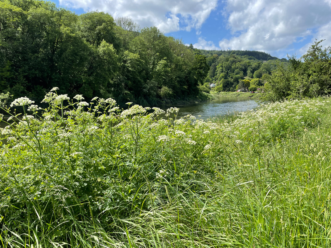
Mae’r daith yn cychwyn o hen orsaf trên Tyndyrn, wedyn mae’n dilyn afon Gwy cyn mynd drwy Tyndyrn i gyrraedd olion yr Abaty. Wedyn croesi’r afon i ddringo ar “lwybr y mynachod” i gyfeiriad pentre Brockweir. Yn sgil mynd heibio i’r hen gei, cyrhaeddir pentre Brockweir a chroesir afon eto yn ôl i’r hen orsaf.
Uchafbwyntiau’r daith: Yr hen orsaf a rheilffordd, cerfluniau pren ffigurau hanesyddol, Eglwys San Mihangel, hen felin, Abaty Tyndyrn, hen dŷ meistr yr harbwr, hen bont reilffordd. llwybr y mynachod, Eglwys Morafia, pentre Brockweir.
Uchafbwyntiau’r daith: Yr hen orsaf a rheilffordd, cerfluniau pren ffigurau hanesyddol, Eglwys San Mihangel, hen felin, Abaty Tyndyrn, hen dŷ meistr yr harbwr, hen bont reilffordd. llwybr y mynachod, Eglwys Morafia, pentre Brockweir.
Walk 19 Friday 5 April
|
|
|
Distance: 3.5 miles (circular)
Duration: 2-3 hours Difficulty: Moderate Bring: Drinks, snacks and a camera Meeting Point and Parking: 10:00am at Tintern Old Station car park, A466 Tintern NP16 7NX SO535006 ///warp.toolbar.shared. Please park in the overflow car park (small charge applies - pay machine by the entrance). Public Transport: Service 69 (Chepstow - Tintern - Monmouth) This walk is not suitable for dogs |
The route starts from the Old Station Tintern, then follows the river Wye before going through Tintern to reach the Abbey remains. It then crosses the river to climb the “Monks’ Trail” towards the village of Brockweir. After passing the old quay it reaches Brockweir village then crosses the river again and back to The Old Station.
Walk highlights: The Old Railway Station, historical wooden carvings, St Michael’s Church, an old mill, Tintern Abbey, old harbour-master’s house, old railway bridge, “Monks’ Trail”, the Moravian Church and Brockweir Village.
Walk highlights: The Old Railway Station, historical wooden carvings, St Michael’s Church, an old mill, Tintern Abbey, old harbour-master’s house, old railway bridge, “Monks’ Trail”, the Moravian Church and Brockweir Village.
Walk 20 Friday 5 April
The Railway Walk part 1 ***CANCELLED DUE TO LANDSLIP AND ROCK FALL***
Walk 21 Friday 5 April
|
|
Distance: 5 miles (circular)
Duration: Allow 2-3 hours Difficulty: Moderate Bring: Snack, drinks and a camera Meeting Point and Parking: 10:00am at the layby by the junction of High Street and the B4228 at St Briavels GL15 6TD SO558042 ///inflame.banks.reset This walk is suitable for active well-behaved dogs - please note there are some stiles |
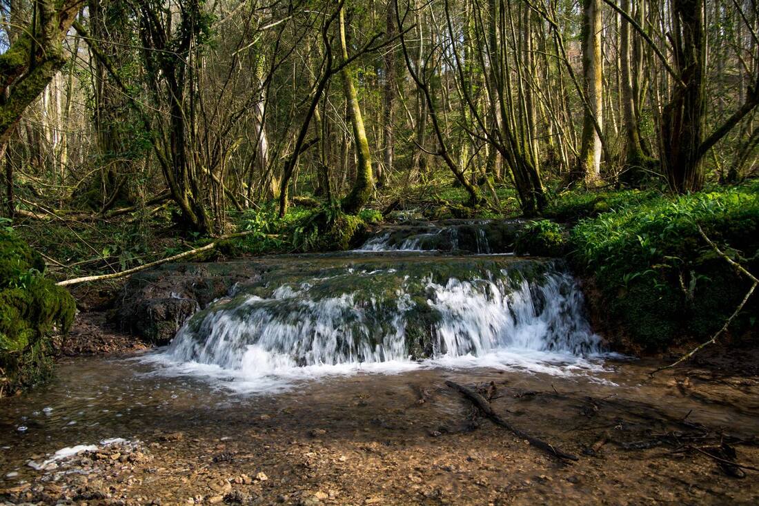
A walk through fields, ancient paths and bluebell woods with stunning views overlooking the Wye Valley. The route follows the sparkling Slade Brook, a Site of Special Scientific Interest with its unusual and rare tufa dams.

Explore the farming landscape of the lower Wye Valley on the paths and tracks around Brockweir, led by staff from the Wye Valley National Landscape Team. Find out about nature recovery and flood management activities. At lunchtime there will be a tasting session at Mackenzie Hall, and a chance to meet the team Cowshill Farm and learn about their work.
|

Walk 23 Friday 5 April
|
|
Distance: 5.5 miles (circular)
Duration: Allow 3-4 hours Difficulty: Moderate Bring: Snacks, drinks and a camera Meeting Point and Parking: 10:00am at Newchurch Farm Shop car park, Newchurch NP16 6DD ST452976 ///teams.amazed.spine This walk is not suitable for dogs |
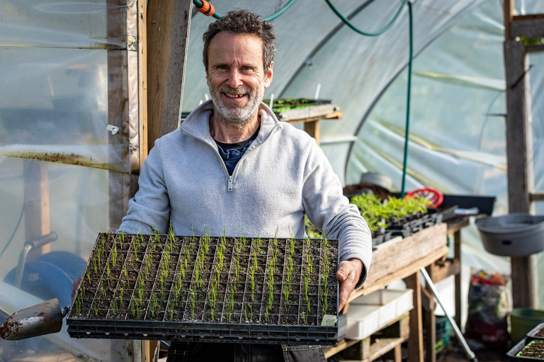
Join local community benefit society Our Food 1200 on a walk around Newchurch and a variation on last year’s route exploring new paths with equally stunning views. On the way we’ll visit Leigh Ayland of Oakfield Growers, to discover the benefits of organic and no-dig methods of growing and see first-hand the hard work and meticulous planning that goes into running a successful seasonal veg box scheme.
(Our Food 1200 is working to create a thriving network of small-scale market gardens serving local communities and beyond.
Eating more seasonal, locally grown fruit and veg is one of the best things you can do to reduce your carbon footprint)
(Our Food 1200 is working to create a thriving network of small-scale market gardens serving local communities and beyond.
Eating more seasonal, locally grown fruit and veg is one of the best things you can do to reduce your carbon footprint)

Our Food 1200

Oakfield Growers

Walk 24 Friday 5 April
Clytha and Bettws Newydd Church
|
Distance: 6.5 miles (circular)
Duration: Allow 4-5 hours Difficulty: Moderate with some ascent and stiles Bring: Snack, drinks and a camera Meeting Point and Parking: 2:00pm at Clytha riverside car park, Clytha Estate, NP7 9BW SO361085 ///finest.cabbies.changed (heading west on Clytha Road from Raglan roundabout, turn left signed Bettws Newydd 0.5 miles after passing The Clytha Arms, the car park is on the right after 0.2 miles) This walk is not suitable for dogs |
This walk offers stunning views across the Usk Valley and beyond to the Brecon Beacons. The route takes in part of the Usk Valley Walk alongside the river Usk, the lovely hamlet of Bettws Newydd with its stunning church, an Iron Age Hill fort and a folly. We may spend a little time at the fifteenth century church, which is located at the crossroads of some of the Usk Valley’s most ancient walk paths, to learn more about its history.
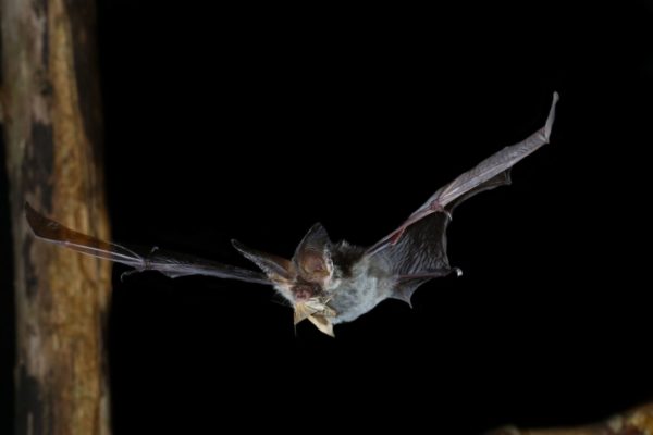
Join members of the MonLife Team for this fascinating walk in the grounds of Caldicot Castle. Why do bats come out at night? Why do they hang upside down? Which is the smallest bat? What do they eat? Find answers to these questions and lots more! We will hopefully see bats and a chance to use electronic bat detectors which will allow us to hear them in flight.
|